
A statement from the B.C. government says hot weather is expected to accelerate snowmelt throughout the Interior through Friday, followed by heavy rainfall.
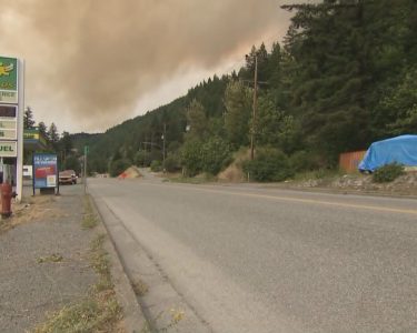
CACHE CREEK, B.C. — The first spell of summer-like weather in British Columbia has sped up snowmelt in the mountains, causing flooding and mudslides that have prompted evacuation orders and highway closures in several areas of the province’s southern Interior.
A statement from the B.C. government says hot weather is expected to accelerate snowmelt throughout the Interior through Friday, followed by heavy rainfall.
The statement issued late Wednesday says conditions in areas that are currently flooding, including Cache Creek and Okanagan Indian Band territory, were expected to deteriorate, while “moderate flooding” was likely in Grand Forks starting Friday.
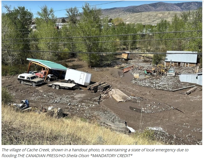
Stretches of highways 1 and 97 remain closed in both directions as the routes intersect in the Village of Cache Creek, where Mayor John Ranta has said floodwaters were flowing in one door of the community firehall and out the other.
One home in the village west of Kamloops is likely lost, and the number of properties under evacuation order has ticked up to 13 from five earlier Wednesday.
To the east, the Okanagan Indian Band has expanded the evacuation order for properties in the community of Parker Cove on the shore of Okanagan Lake, where it says floodwaters from Whiteman Creek have eroded land and undercut trees.
Meanwhile, the Regional District of Central Kootenay as put three more properties on evacuation alert in response to a landslide and debris flowing Talbot Creek in the community of Vallican, east of Kamloops, where photos shared by the district show the water has carved a deep channel through Little Slocan South Road.
A mudslide has forced the closure of an 80-kilometre stretch of Highway 3 between Salmo and Creston, causing longer wait times for the Kootenay Lake ferry.
Highway 3 is also closed in both directions due to flooding about 15 kilometres east of Castlegar, while a short stretch of Highway 99 is closed due to flooding about 67 kilometres north of Lillooet, with assessments underway in both areas.
Heading into the weekend, the province’s statement issued late Wednesday says “significant flood hazard is expected throughout small and medium-sized watersheds in the Central Interior, Okanagan, Boundary and Southern Kootenays.”
It says sandbags and other barriers have been deployed to at-risk communities, and people in affected areas are encouraged to make household emergency plans.
The City of Penticton says it has set up sandbag station as a precautionary measure, saying water levels in Penticton and Ellis creeks have risen, but officials are confident the creeks and surrounding lakes will be able to absorb the freshet.
Source/The Canadian Press