
If you woke up sweating in the middle of the night or Wednesday morning, you’re probably not alone, as the Lower Mainland is bracing for soaring temperatures.
The overnight lows will also increasingly feel like daytime highs, hitting anywhere between 17 to 19 degrees, depending on where you live.
Hot and humid today. Hazy too with wildfire smoke mainly aloft. Near record heat lasts through Friday. #heat #Summer @CityNewsVAN pic.twitter.com/QohJJ78t0T
— Michael Kuss (@Kusswx) July 5, 2023
CityNews Meteorologist Michael Kuss says one of the reasons the temperatures feel so uncomfortable is the humidity.
“It’s not only the daytime heat where temperatures across the region are soaring up to 30 degrees and will continue to do so through the end of the week,” he explained. “The humidity is there as well, so humidex readings are 30 to 35 degrees, and most of the area is really in that 34-, 35-degree range and we’ll have that through the end of the week.”
With the temperatures creeping up, you may be worried about the air quality, but Kuss has some good news on that front.
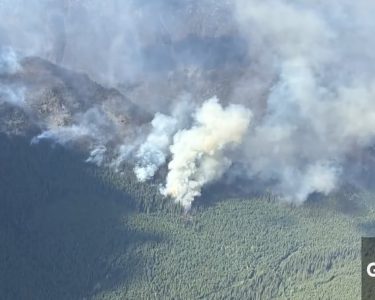
“Two main factors are determining the weather this week. We’re getting warm air pumping up from the south and that’s going to be the case through Friday and then higher up in the atmosphere the winds are mainly out of the north-northeast, so we’re getting smoke filtering down from the wildfires in northeastern B.C. That will be the case all week long,” he said.
“The good news is most of that higher level smoke isn’t filtering all the way down to the surface, so although it looks hazy out there, the air quality is going to hover in that good to moderate range through Friday.”
A number of temperature records fell across B.C. on Tuesday, including in Gibsons, Hope, Squamish, Victoria, and White Rock. In some of these cases, records have been kept as far back as 1914.
“Record highs for this time of year on the South Coast range from about 27 degrees near the water to 31 or 32 degrees inland. We’re expecting to see temperatures in that range all week long. The pattern is a classic mid-summer pattern where we get warm air at the surface,” said Kuss.
He says there is no significant rainfall in the forecast for the next one to two weeks.
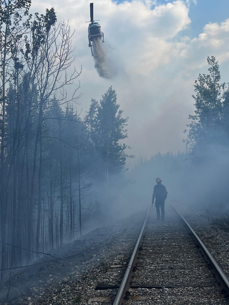
This heat comes as crews try to gain the upper hand on almost 100 wildfires burning province-wide right now, including the Donnie Creek wildfire near Fort St. John. It’s considered the biggest in B.C. history and is bigger than all of Prince Edward Island.
This weather shouldn’t surprise anyone. Last month, Environment and Climate Change Canada (ECCC) released its summer outlook and predicted B.C. would see higher-than-normal temperatures.
The federal agency says climate change has affected the duration and intensity of extreme weather in this country, with models suggesting Canada is warming at roughly double the global rate.
B.C. has already dealt with a few mini heatwaves this year, when temperatures hit the 30s including back in May when it felt like we skipped spring and jumped straight into an early summer.
ECCC previously cautioned Canadians from coast to coast to monitor conditions and take weather alerts seriously as many provinces struggle with widespread wildfires.
source & photo : CityNews