The province is urging people to prepare for stormy weather and heavy rain across the Fraser Valley, Vancouver Island, and the Lower Mainland over the next week.
A forecast from Environment and Climate Change Canada shows an atmospheric river is on the way to the area.
“Narrow bands of heavy precipitation such as this are common in British Columbia and many occur every year, most frequently in the fall and winter,” the province said.
As a result, “heavy to very heavy rain” is expected to hit the Fraser Valley, the Lower Mainland, the Howe Sound, and the western part of Vancouver Island on Monday and Tuesday. The province says this will be the “peak of the storm.”
CityNews Meteorologist Michael Kuss explains the rain usually comes in waves at this time of the year, and that’s what we’re seeing.
“We were talking about how dry it’s been this year, but we’re into the wet weather now, and that lasts at least into the middle of next week,” Kuss said.
“I wouldn’t be shocked, for the Lower Mainland and in a fairly widespread way, for 150 millimetres over this five day stretch.”
Kuss adds that while this kind of weather is generally seasonal, it’s the lack of precipitation we’ve had that makes it feel like a switch has been flipped.
“The series of storms started coming through the area Thursday, and some of these storms could bring 40 to 50 millimetres individually.”
When it comes to snow, the province says it is unsure how much will hit affected areas over the course of the storm.
Those in low-lying areas are asked to prepare for possible flooding. People in affected areas are also advised not to drive or walk in flood water, as “rushing water can carry away most vehicles.”
The province adds that the River Forecast Centre will monitor the weather and issue any additional advisories and warnings as needed.
Kuss explains the heavy rain, coupled with the sustained lack of precipitation this year, will result in some localized flooding, high streamflow advisories, and even potentially some landslides in the Interior.
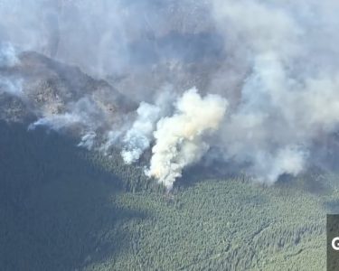
“We’re watching out for that, especially with the fire-scorched earth at a lot of locations,” Kuss said.
source & photo : CityNews